The “Big Island” of Hawaii is an amazing place to visit where you can snorkel with turtles, lay on the beach, ski a volcano or hike in a lava tube. The 3 national park units on the Big Island should be included in your itinerary. Let me explain why.
Table of contents: ()
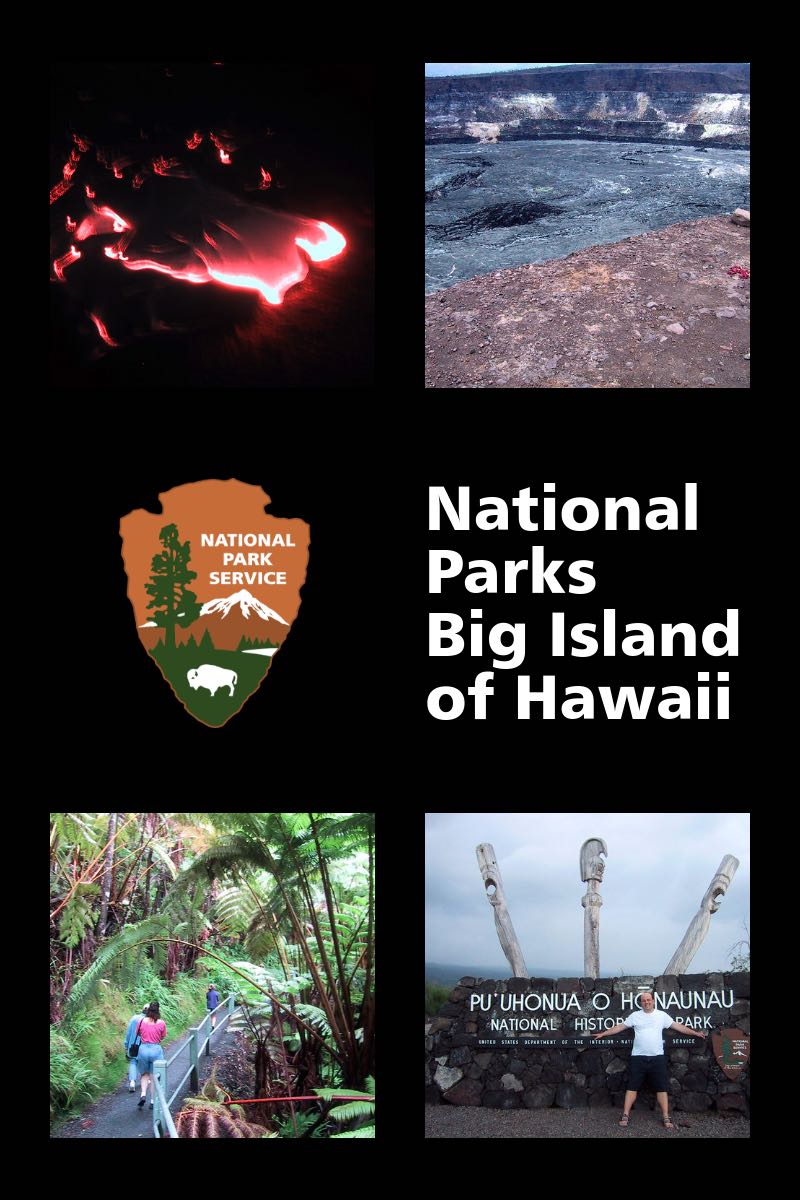
Hawai’i Volcanoes National Park
The largest and best-known national park on the Big Island is Hawai’i Volcanoes National Park. This park is worth flying to the Hawaiian Islands just to see it alone.

Lava at Volcanoes National Park
Lava Flows
Pu’u O’o is an active volcano vent on the Kilauea volcano that has been erupting continuously since January 3rd of 1983. Much of the time the lava that issues from this vent flows in underground lava tubes and is visible only when it crashes into the ocean in a spectacular pyrotechnic display. But if you are lucky… so very very lucky… when you’re visiting Volcanoes National Park there might be surface flow. We were that lucky once.
Two park rangers stood between me and lava that was flowing in my direction. They were there to make sure that no one did anything stupid… as if just standing in front of flowing lava was not stupid in and of itself.

hiking across old lava flows
We parked at the end of Chain of Craters Road. This road used to be a through road on this part of the island but has been covered with lava since 2003. The local towns of Kalapana and Kaimu were also covered with lava. Armed with a flashlight and good walking shoes we arrived at the end of the road near the end of the day. The best time to see lava is in twilight and early evening. Our visit to walk to where the lava flow was active was about a mile over the uneven surface of previous flows. The National Park Service had mapped out what we hoped to be a safe route.
We arrived at the spot where lava was slowly flowing down the hill towards us. The kind of stupid things the Rangers were protecting against, they told us, included people poking 1500° lava with the stick and accidentally flinging it at their friends. This is something they try and avoid. While we stood and watched the lava flow a soft rain started. No problem. We just stepped one step closer to the incredibly hot lava and dried off in no time.
If you are fortunate enough to have a surface flow, you should also bring a tripod so you end up with better pictures than I did.
If you happen to be on the Big Island during a time when the lava flow is active, I highly recommend a helicopter tour.
Hawai’i Volcanoes National Park – Always Changing
Hawai’i Volcanoes National Park is probably the most dynamic of the national parks. If you look at my pictures from my trip, you will see pictures of lava flows that were flowing when I was there but will likely be solid during your trip. On the other hand, since I was last at the park the main caldera pictured below (Halema’uma’u) filled with lava in 2008. It is a park that you can go back to again and again and may not be the same twice.
As I was comparing the satellite map on Google with the road map it is clear that even Google as trouble keeping up with the change as one road that was shown on the road map has clearly collapsed into the Halema’uma’u Crater.

Halema’uma’u Crater
Hawai’i Volcanoes National Park Map
Crater Rim Drive
Even if your visit to Volcanoes National Park is not as fortuitous as ours the park is still definitely worth a stop. The 11 miles long Crater Rim Drive circles the Kilauea volcano caldera or at least it used to circle the large Halema’uma’u Crater. As of this writing, the volcano ate part of the road but this is still the main drive to see the highlights of the park.
Kilauea Visitor Center
Stop at the Kilauea Visitor Center to get your National Park Passport stamped (or to buy one if you don’t have one). Like the other great national parks in the U.S., this is where you can also watch an introductory film and find the schedule for ranger-lead hikes and presentations.
Steam Vents and Sulphur Banks
The first stop on the Crater Rim Drive is for two different spots. The first is a set of steam vents and the second is sulfur banks. These are not the most impressive feature of the park and if you are tight for time, I might skip this stop.

Kilauea Iki Crater from the Pu’u Pua’i Overlook
Kilauea Iki Overlook
Your first chance to look down into one of the craters in the park is at Kilauea Iki Overlook. This is also the trailhead for the trail that will bring you down into the Kilauea Iki Crater, assuming Madame Pele is cooperating. This is one of the most popular hikes in the park. The floor of the crater is 400 feet below you. Kilauea Iki crater is a mile long and more than half a mile wide, but no, it is not the biggest crater in the park. This crater formed with the 1959 eruption which shot lava fountains 1,900 feet into the air.
Nahuku – Thurston Lava Tube
If you want to see more evidence of volcanic activity you can tour the Thurston lava tube which is off the Crater Rim road. The Nahuku (or Thurston Lava Tube) is a half-mile easy hike from the parking lot through a lush forest.
The lava tube is a cave was created by hot lava 500 years ago. It is no longer filled with hot lava and has been reclaimed by the local rainforest. The entrance portion of the cave does have lights but the more adventurous might want to bring a flashlight to explore a little further.
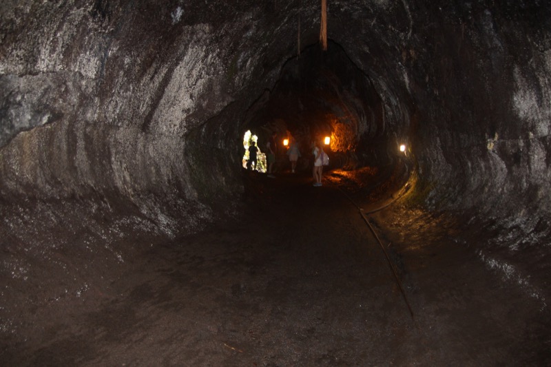
Nahuku – Thurston Lava Tube Image by David Intersimone from Pixabay
Lava tubes are an interesting characteristic of the kind of volcanic activity that you will find in Hawaii. When one of Hawaii’s volcanos spews out hot lava, the surface of the lava, which is exposed to the air will cool faster than the underlying river of lava. Eventually, the river of lava will crust over as it makes its way inexorably to the ocean. After the end of the eruption, the lava will drain from this tube and leave behind a lava tube.
Parking is quite limited so the park service recommends you stop here early or late in the day. If you have never hiked in a lava tube, I would put this near the top of your to-do list.
Pu’u Pua’i Overlook
The Pu’u Pua’i Overlook provides another look into the Kilauea Iki Crater. It is also one of the two trailheads for the Devastation Trail.

Pele’s Tears
Devastation Trail
The Devastation Trail is an easy .5 mile hike between the Pu’u Pua’i Overlook and the Devastation Trail parking area. The trail is paved and is wheelchair and stroller friendly. You can hike it in either direction, but hike it you should.
As you hike over the lava from the 1959 Kilauea Iki eruption, you can look for Pele’s tears or Pele’s hair. Keep a sharp eye on the ground for Pele’s tears, these are drops of lava that cool before they hit the ground into a teardrop shape that the Hawaiians thought was from the Goddess Pele from whom all lava flowed. Pele’s hair (which is a bit harder to spot) is longer thread-like strands of lava.
Watch for the two different types of lava on the ground. The smooth ropy lava is called pahoehoe (5 syllables) and the sharp lava is called a’a. The easy way to remember that is that “ah ah!” is what you would say if you walked on sharp lava in bare feet.
Also, note how the plans are reclaiming the lava. In areas where there is rain, the vegetation can come back in a single lifetime.
Keanakako’i Crater
The parking area at Keanakako’i Crater is between one of the smallest craters in the park, Keanakako’i Crater, and the largest, Halema’uma’u Crater. As of this writing access to Keanak?ko’i Crater has been restored after the last big eruption, but access to Halema’uma’u Crater had not.

Best Named U.S. National Park
Pu’uhonua O Honaunau National Historical Park
There are two other National parks on the Big Island, both of which focus on Hawaiian culture. The first of these is the best named of all US National Parks, the Pu’uhonua O Honaunau Historical Park. This park preserves a sacred place of refuge. If you violated one of the sacred laws of Hawaii, the kapu, your punishment could be death. But you could flee to a place like Pu’uhonua O Honaunau to save your life. Breaking the law could be as simple as fishing, planting, or harvesting at the wrong time or in the wrong place.
Pu’uhonua O Honaunau was also a place you could flee to in time of war.
It is a wonderful peek into the story of the native Hawaiians that my kids enjoyed when they were in late elementary school. This park is one of the reasons that I recommend the National Park Passport. Volcanoes National Park is hard to miss, but we would not even have heard of this park without checking what other parks were nearby.
Puukohola Heiau National Historic Site
The last park on Hawaii is Puukohola Heiau National Historic Site. A heiau is a temple but it looks, to my untrained eye, like a pile of stones. I found this park to be long on cultural significance but less approachable for a haole like me.
+Chris Christensen | @chris2x | facebook
2 Responses to “National Parks in Hawaii on the Big Island: Volcanos and History”
Leave a Reply
Tags: article, big island, hawaii, national park


 Hawaii, the big island – Episode 55
 Travel to the Big Island of Hawaii – Episode 629
 Maui – Road to Hana and Lava Tubes – Video Episode 61
 Petroglyphs on the Big Island of Hawaii

John Emmanuel Cruz
Says:March 6th, 2014 at 5:34 pm
Wow, that trip was sure fun! I may not be as fortuitous as you (watching the flowing lava) but I feel like I was already there while reading your post;) Thanks for sharing dude!
chris2x
Says:March 7th, 2014 at 12:36 am
Thanks John!