
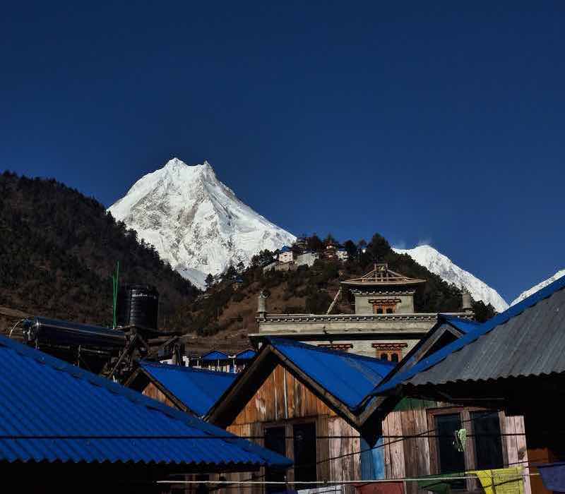
Mount Manaslu
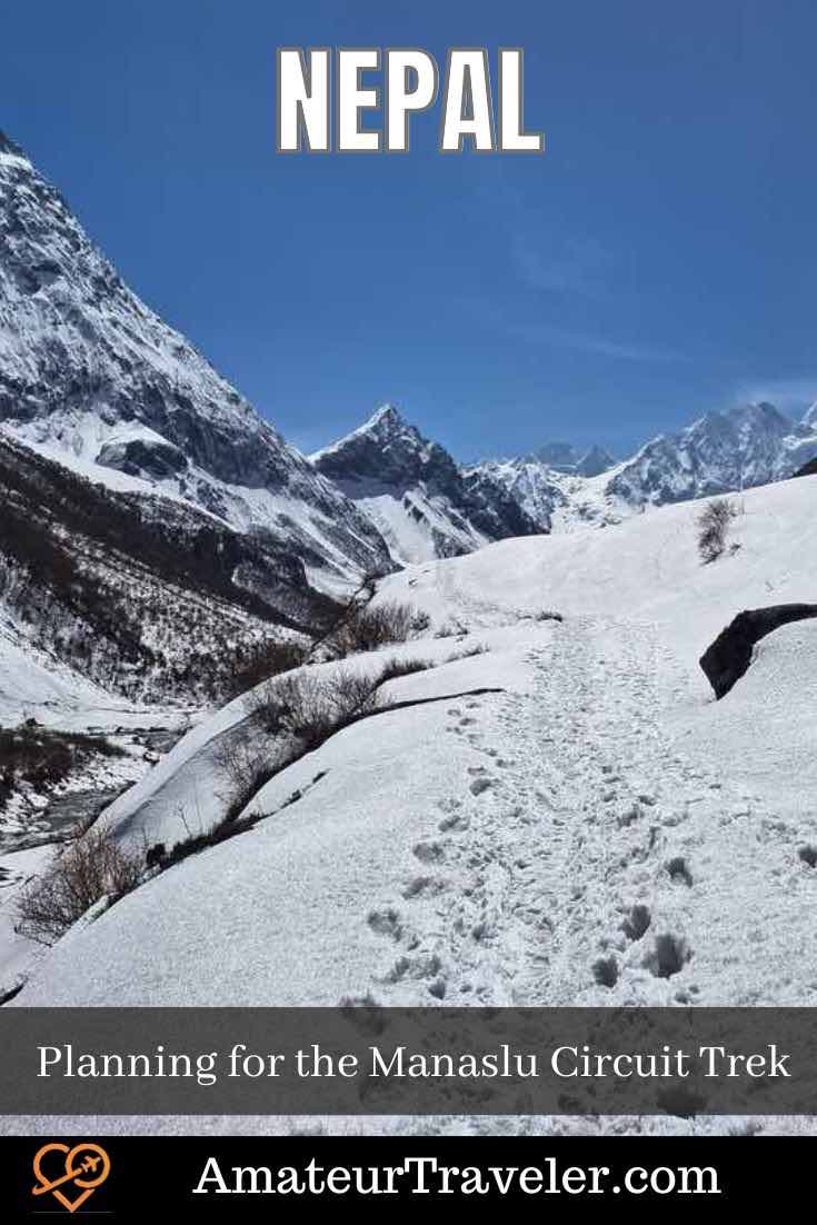
The Manaslu Circuit Trek circles Manaslu, the world’s eighth-highest peak at 26,781 feet (8,163 meters). It offers an adventure through Nepal’s remote regions, with diverse landscapes, forests, and culturally rich villages.
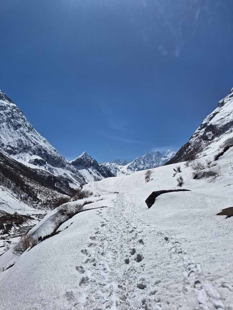
Starting in Macha Khola, the trail includes rhododendron forests, glacial valleys, and high mountain passes.
Crossing the Larkya La Pass at 16,847 feet (5,135 meters) provides panoramic views of Manaslu, Himlung Himal, Cheo Himal, and the Annapurna range. I trekked the Manaslu Circuit in April 2024 and had an amazing experience, making it the adventure of a lifetime.
The trek’s cultural richness is fascinating, with traditional Tibetan-influenced villages like Namrung, Samagaon, and Samdo. You’ll visit ancient monasteries, witness Buddhist ceremonies, and experience the hospitality of the Gurung and Tibetan communities.
The trek’s challenges—steep ascents, high altitudes, and varying weather—make it even more rewarding. In this article, I will share complete, in-depth information about the Manaslu Circuit Trek to help you plan your adventure.
Table of contents: ()
- When is the best time to do The Manaslu Circuit Trek?
- Manaslu is a restricted area trek.
- Accommodation in Manaslu Circuit Trek
- Food in Manaslu Circuit Trek
- Crossing the Larke La Pass
- What to Wear on Manaslu Circuit Trek?
- Manaslu Circuit Trek Itinerary
- Day 1: Kathmandu to Maccha Khola
- Day 2: Maccha Khola to Jagat
- Day 3: Jagat to Deng
- Day 4: Deng to Namrung
- Day 5: Namrung to Lho
- Day 6: Lho to Samagaun
- Day 7: Acclimatization day at Samagaun
- Day 8: Samagaun to Samdo
- Day 9: Samdo to Dharamsala
- Day 10: Acclimatization Day in Samdo
- Day 11: Dharamshala to Bhimtang
- Day 12: Bhimtang to Dharapani
- Day 13: Dharapani to Kathmandu
- Health Risks on the Manaslu Circuit Trek
Larke Pass
When is the best time to do The Manaslu Circuit Trek?
The best time to do the Manaslu Circuit Trek is during the pre-monsoon (spring) and post-monsoon (autumn) seasons:
Spring (March to May)
This season offers clear skies, moderate temperatures, and blooming rhododendrons, making the trek especially beautiful. The trails are lush and colorful, and the weather is generally stable.
Autumn (September to November)
Autumn is considered the best time to trek the Manaslu Circuit. The post-monsoon period brings clear skies, excellent visibility, and mild temperatures. The trails are drier, and the views of the mountains are stunning. This season also sees many festivals in Nepal, providing a cultural experience along with the trek.
Winter (December to February)
Trekking the Manaslu Circuit during winter presents both unique beauty and significant challenges. The landscape is transformed by snow, creating a serene and picturesque environment with fewer trekkers on the trails. The crisp, clear air often offers stunning, unobstructed views of the surrounding peaks.
However, winter trekking also comes with harsh conditions. Temperatures can drop significantly, especially at higher altitudes, often falling below freezing at night.
The Larkya La Pass, at 16,847 feet (5,135 meters), can become particularly treacherous due to heavy snowfall and icy conditions, potentially making it impassable. Accommodation options in higher villages may be limited, as some tea houses close for the season.
Proper preparation is essential for a winter trek. Trekkers need to be well-equipped with appropriate cold-weather gear, including thermal clothing, good quality sleeping bags, and crampons for icy sections.
Additionally, having a flexible itinerary and an experienced guide is crucial to navigate the winter challenges safely.
Why is it not recommended to trek in Monsoon?
Trekking the Manaslu Circuit during the monsoon season (June to August) is generally not recommended due to several challenging factors. The period is marked by continuous heavy rainfall, making the trails muddy, slippery, and prone to landslides, which can pose significant risks to trekkers.
The persistent rain also obscures mountain views, diminishing the scenic beauty of the trek. Additionally, the monsoon brings a surge of leeches and insects, adding to the discomfort. The swollen rivers and streams can make crossings dangerous, and the increased cloud cover often leads to poor visibility.
Furthermore, many teahouses and lodges along the trail may be closed or offer limited services due to the off-season, affecting accommodation and support options. These factors combined make the monsoon season a less favorable and more hazardous time for trekking the Manaslu Circuit.
Manaslu is a restricted area trek.
You need a Guide to do this trek
The Manaslu Circuit Trek is considered a restricted area trek in Nepal, which means it falls under special regulations imposed by the Nepalese government. Here’s why a guide is required for this trek:
- Permit Requirements: To trek in restricted areas like Manaslu, you need a special permit issued by the government. These permits are typically issued only to organized trekking groups and not to individual trekkers.
- Safety and Navigation: The Manaslu region is remote and rugged, with challenging terrain and variable weather conditions. A local guide who is familiar with the area can ensure your safety, navigate the trails effectively, and provide assistance in case of emergencies.
- Cultural Sensitivity: The Manaslu region is home to diverse ethnic communities and their cultural practices. A guide can facilitate respectful interactions with local communities and ensure that you adhere to local customs and traditions.
- Environmental Conservation: Guides play a crucial role in promoting responsible trekking practices and environmental conservation efforts in restricted areas.
I trekked the Manaslu Circuit with Magical Nepal, a local Nepal-based travel company. They expertly managed permits, provided experienced guides, and ensured a safe and well-planned adventure tailored to the circuit’s unique challenges.
Accommodation in Manaslu Circuit Trek
Accommodations on the Manaslu Circuit Trek mainly consist of teahouses—basic lodges offering simple rooms. It’s essential to note that teahouses usually do not provide blankets.
Therefore, you’ll need to bring your own sleeping bag for warmth, especially at higher altitudes where temperatures can drop significantly. While tea houses provide mattresses and pillows, having a sleeping bag ensures you have a comfortable and cozy night’s sleep during your trek.
Food in Manaslu Circuit Trek
You’ll find a variety of food options available at the tea houses along the trail. Here’s an overview of the typical food and considerations regarding water:
- Food Options: Teahouses along the Manaslu Circuit offer a range of meals, including:
- Dal Bhat: A traditional Nepali dish consisting of rice, lentil soup (dal), vegetables, and sometimes meat. It’s a staple for many trekkers due to its high-energy content.
- Noodles and Pasta: Often available with vegetables or eggs, providing a quick and filling meal.
- Soups: Warm and comforting, especially at higher altitudes.
- Snacks: For a quick energy boost, momos (dumplings), pancakes, and fried potatoes are common.
- Beverages: Tea (like masala chai), coffee, hot chocolate, and soft drinks are available for hydration and warmth.
- Water: It’s crucial to treat water carefully on the trek. While bottled water is available for purchase at teahouses, bringing water purification tablets or a filter is recommended.
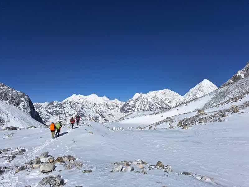
Crossing the Larke La Pass
Crossing the Larke La Pass
Crossing Larke La Pass on the Manaslu Circuit Trek will be a formidable challenge but an incredibly rewarding experience. To tackle this ascent, you’ll wake up very early, typically around 4 AM or earlier, to begin the steep climb from the teahouses below.
This early start is crucial due to the unpredictable weather conditions at high altitudes, especially the strong winds that intensify later in the day. Starting early will also minimize the risk of encountering snowfall or poor visibility.
As you ascend towards Larke La Pass, which stands at approximately 5,106 meters (16,752 feet) above sea level, you’ll notice the air becoming thinner. This necessitates a steady pace to conserve energy and acclimatize effectively.
Make sure you’re well-prepared with warm layers of clothing, gloves, a hat, and possibly crampons if there’s snow or ice on the trail. Sunglasses and sunscreen are essential due to the intense sunlight at these heights.
Upon reaching the top of Larke La Pass, you’ll be greeted with awe-inspiring panoramic views of the surrounding Himalayan peaks, including the majestic Manaslu and Himlung Himal.
Take your time to absorb the breathtaking scenery before beginning the steep and challenging descent on the other side. Trekking poles can be incredibly helpful here for stability and to ease the strain on your knees during the descent.
Once you safely descend from Larke La Pass, you’ll likely stop at a teahouse in Bumthang to rest, replenish your energy with food and hydration, and reflect on your accomplishment of conquering one of the trek’s highest points.
This crossing will test your physical endurance but will undoubtedly provide you with an unforgettable experience amidst the stunning beauty of the Himalayas.
Larke Pass
What to Wear on Manaslu Circuit Trek?
When preparing for the Manaslu Circuit Trek, consider the following clothing and gear recommendations:
- Base Layers: Lightweight, moisture-wicking clothing to manage sweat and keep dry.
- Insulating Layers: Fleece jackets or pullovers for warmth at higher altitudes.
- Outer Shell: Waterproof and windproof jacket and pants to protect against rain, wind, and snow.
- Trekking Pants: Quick-drying pants suitable for varying temperatures; consider convertible options.
- Headwear: Warm beanie or hat, sunglasses with UV protection, and a wide-brimmed hat or cap for sun protection.
- Gloves: Lightweight gloves for lower altitudes and insulated gloves or mittens for higher altitudes.
- Footwear: Sturdy, waterproof hiking boots with ankle support. Microspikes are recommended for traction on icy sections.
- Socks: Moisture-wicking socks to prevent blisters; carry extra pairs.
- Sleeping Bag: A warm, lightweight sleeping bag suitable for cold temperatures. You can rent one in Kathmandu before your trek.
- Jacket: A down jacket or insulated jacket for additional warmth during rest periods. Rental options are available in Kathmandu.
- Miscellaneous: Pack a swimsuit for hot springs, comfortable clothes for evenings, and any personal hygiene items.
Manaslu Circuit Trek Itinerary
Day 1: Kathmandu to Maccha Khola
- Distance: 60 km / 99 miles
- Time: 8 to 10 hours
- Altitude: 850 meters/ 2788.71
You start your journey from Kathmandu, traveling 160 km / 99 miles to reach Maccha Khola. The drive takes you through picturesque landscapes, including terraced fields, small villages, and the Trishuli River.
After a stop in Arughat Bazar, the road narrows and follows the Budhi Gandaki River, offering stunning views of lush green hills and waterfalls.
Finally, you arrive in the quaint village of Maccha Khola, where the sound of the flowing river provides a serene contrast to the city. You settle into a teahouse for the night, excited to begin your trek on the Manaslu Circuit in the morning.
- Search for Great Tours HERE
- Get a Car Rental
- Book Your Accommodation HERE
- Buy Travel Insurance
- Get a universal plug adapter
- Get an eSim to be able to use your smartphone abroad.
Day 2: Maccha Khola to Jagat
- Elevation: Jagat (1,410 meters / 4,626 feet)
- Distance: Approximately 22 kilometers (13.7 miles)
- Duration: 6-7 hours of trekking
- Elevation Gain: Approximately 480 meters (1,575 feet)
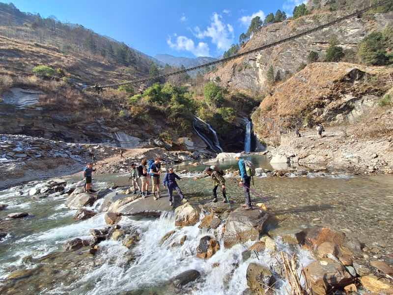
You will follow the Budhi Gandaki River through lush forests, terraced fields, and small villages, reaching Khorla Besi, where you can take a short break. The trail then leads to Tatopani, famous for its natural hot springs, perfect for a relaxing soak.
Continuing, you pass through more forests and cross several suspension bridges to reach Dovan, ideal for a lunch break. The final leg involves a steeper ascent to Jagat, with the landscape transitioning to cultivated fields and traditional houses.
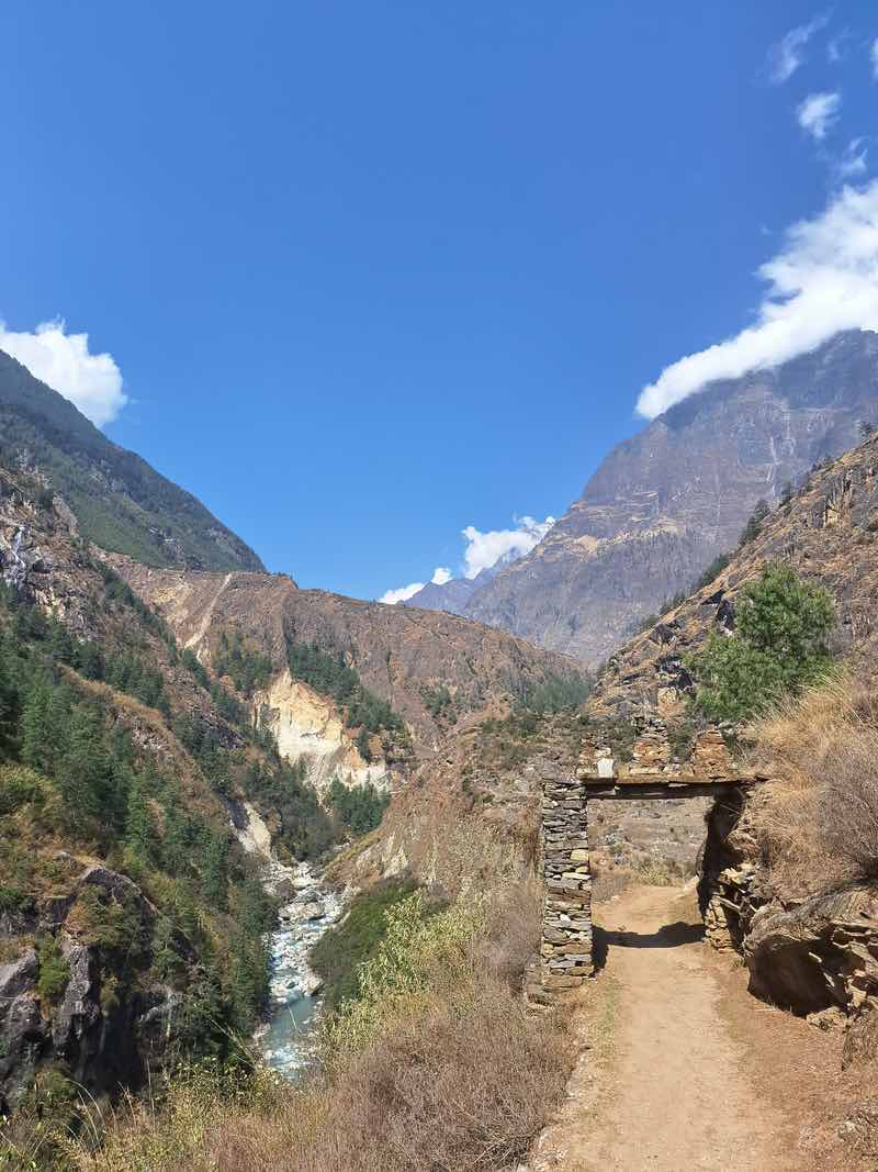
Jagat marks the entry into the Manaslu Conservation Area, where your permits will be checked. Along the way, you’ll experience diverse scenery, cultural encounters with Gurung and Tibetan-influenced communities, and the thrill of crossing suspension bridges.
To ensure a smooth trek, start early, stay hydrated, wear comfortable footwear, carry high-energy snacks, and be prepared for rapid weather changes with appropriate clothing layers.
Day 3: Jagat to Deng
- Starting Point: Jagat (1,410 meters / 4,626 feet)
- Ending Point: Deng (1,860 meters / 6,102 feet)
- Distance: Approximately 20 kilometers (12.4 miles)
- Duration: 7-8 hours of trekking
- Elevation Gain: Approximately 450 meters (1,476 feet)
The trek from Jagat to Deng on the Manaslu Circuit is an exhilarating journey covering approximately 20 kilometers over 7-8 hours, with an elevation gain of around 450 meters. Starting from Jagat at 1,410 meters, you descend to the river before climbing gradually to Salleri.
The trail continues through lush forests and terraced fields, passing the traditional village of Sirdibas. After crossing a suspension bridge over the Budhi Gandaki River, you reach Philim, a larger village perfect for a rest or lunch break.
The path then winds through fields and forests to Ekle Bhatti and becomes narrower and more rugged as it follows the river through a steep gorge to Pewa.
The final stretch to Deng involves a mix of ascents and descents, with the trail occasionally hugging the side of the gorge. Deng, at 1,860 meters, is a small village with basic teahouses, offering a well-deserved rest after a day filled with diverse scenery, thrilling suspension bridge crossings, and cultural encounters in the remote Himalayan landscape.
Day 4: Deng to Namrung
- Starting Point: Deng (1,860 meters / 6,102 feet)
- Ending Point: Namrung (2,630 meters / 8,628 feet)
- Distance: Approximately 19 kilometers (11.8 miles)
- Duration: 6-7 hours of trekking
- Elevation Gain: Approximately 770 meters (2,526 feet)
The trek from Deng to Namrung on the Manaslu Circuit is a captivating journey, spanning approximately 19 kilometers (11.8 miles) and taking about 6-7 hours, with an elevation gain of around 770 meters (2,526 feet).
Starting from Deng at 1,860 meters (6,102 feet), you follow the Budhi Gandaki River, crossing several suspension bridges and passing through traditional Tibetan-influenced villages like Rana and Bihi Phedi. The trail offers a mix of gentle ascents and steeper sections, winding through lush forests and terraced fields.
As you pass through Gap, you’ll encounter colorful main walls and shortens, highlighting the region’s rich cultural heritage. The path continues to ascend gradually, leading you through dense rhododendron and oak forests with occasional clearings that provide stunning mountain views.
Upon reaching Namrung at 2,630 meters (8,628 feet), you’ll find a larger village with better facilities and several teahouses, offering a comfortable place to rest. Throughout this segment, you’ll enjoy diverse scenery, cultural encounters, and increasing views of the surrounding peaks, making it a rewarding and enriching part of the trek.
Day 5: Namrung to Lho
- Starting Point: Namrung (2,630 meters / 8,628 feet)
- Ending Point: Lho (3,180 meters / 10,433 feet)
- Distance: Approximately 10 kilometers (6.2 miles)
- Duration: 4-5 hours of trekking
- Elevation Gain: Approximately 550 meters (1,805 feet)
Starting from Namrung at 2,630 meters (8,628 feet), the trail leads you through beautiful pine and rhododendron forests, gradually ascending to higher altitudes. You pass through the picturesque villages of Banjam and Lihi, where you can observe traditional Tibetan culture and architecture. The route offers spectacular views of Manaslu North and Naike Peak, providing ample opportunities for photography and moments of reflection.
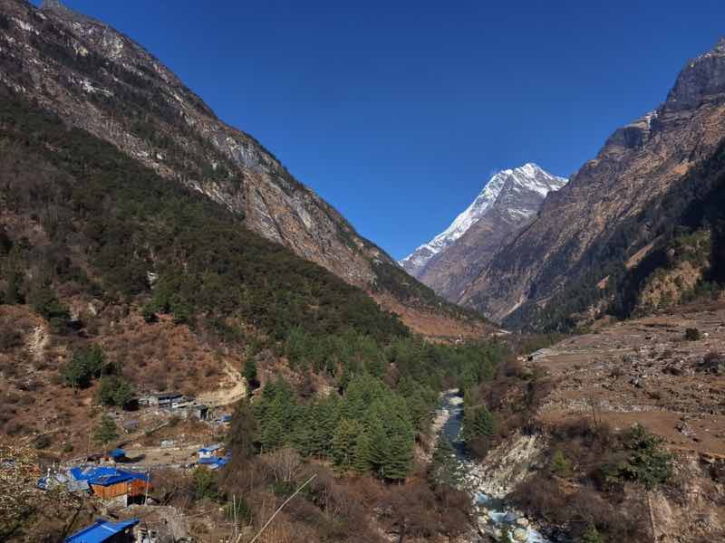
As you continue, the trail becomes more open, revealing extensive fields and pastures. The air becomes crisper and cooler as you climb, and you may feel the altitude more intensely. The village of Lho, situated at 3,180 meters (10,433 feet), offers panoramic views of the majestic Manaslu massif. This village is also home to the Ribung Gompa, a beautiful monastery that is worth visiting for its serene atmosphere and cultural significance.
Upon reaching Lho, you can find several teahouses that provide comfortable accommodations and hearty meals. The village itself is charming, with traditional houses and friendly locals. This section of the trek is relatively short but packed with incredible scenery and cultural encounters, making it a memorable part of the Manaslu Circuit.
Day 6: Lho to Samagaun
- Starting Point: Lho (3,180 meters / 10,433 feet)
- Ending Point: Samagaun (3,530 meters / 11,581 feet)
- Distance: Approximately 15 kilometers (9.3 miles)
- Duration: 4-5 hours of trekking
- Elevation Gain: Approximately 350 meters (1,148 feet)
Starting from Lho, situated at 3,180 meters (10,433 feet), the trail offers immediate, panoramic views of the Manaslu massif and other surrounding peaks. As you leave Lho, you pass by the Ribung Gompa, a significant Buddhist monastery, where you can soak in the spiritual ambiance and observe the daily rituals of the monks.
The trail then leads you through dense pine forests and past small settlements, gradually ascending towards Shyala village. Shyla is a great place to take a break and enjoy the magnificent views of Manaslu and the Himal Chuli peaks. From Shyala, the path continues with a mix of gentle ascents and flat sections, crossing several streams and offering more stunning vistas of the Himalayas.
Continuing onward, you arrive at the expansive and culturally rich village of Samagaun at 3,530 meters (11,581 feet). Samagaun is one of the larger villages on the trek and provides a perfect opportunity to explore traditional Tibetan culture. You can visit the Pungyen Gompa, a sacred Buddhist monastery, or take a short hike to the serene Birendra Tal.
Day 7: Acclimatization day at Samagaun
You spend an acclimatization day in Samagaun, a village nestled at 3,530 meters. This day is crucial for adjusting to the altitude, ensuring you’re prepared for the higher elevations ahead. You start with a relaxed morning, enjoying the serene mountain views.
To aid acclimatization, you take a hike to Birendra Lake or the Pungyen Gompa, both offering stunning views and cultural insights. Alternatively, you can opt for a more challenging hike to Manaslu Base Camp at 4,800 meters, which provides breathtaking views of the surrounding peaks. After exploring, you return to your teahouse, feeling refreshed and ready for the next leg of your trek.
Day 8: Samagaun to Samdo
- Starting Point: Lho (3,180 meters / 10,433 feet)
- Ending Point: Samagaun (3,530 meters / 11,581 feet)
- Distance: Approximately 15 kilometers (9.3 miles)
- Duration: 5-6 hours of trekking
- Elevation Gain: Approximately 350 meters (1,148 feet)
Starting from Lho at 3,180 meters (10,433 feet), the trail offers breathtaking views of the Manaslu massif as you ascend. You pass through the village of Shyala, where you can take in panoramic views of several Himalayan peaks, including Himal Chuli and Peak 29. Shyla is an excellent spot for a short break and some photography, with its stunning backdrop of snow-capped mountains.
Continuing on, the trail leads you through dense pine and rhododendron forests, gradually opening up to reveal expansive fields and pastures. You cross several small streams and suspension bridges, experiencing the region’s pristine beauty. The trail offers a mix of ascents and descents, with the altitude becoming more noticeable as you approach Samagaun.
Samagaun, situated at 3,530 meters (11,581 feet), is one of the larger villages in the region and serves as a central point for trekkers. The village is set against the majestic Manaslu’s backdrop and surrounded by beautiful landscapes.
In Samagaun, you can visit the ancient Pungyen Gompa, a monastery with significant cultural and religious importance. The village also offers several teahouses with comfortable accommodations and a variety of meals.
Day 9: Samdo to Dharamsala
- Starting Point: Samdo (3,875 meters / 12,713 feet)
- Ending Point: Dharamsala (4,460 meters / 14,632 feet)
- Distance: Approximately 8 kilometers (5 miles)
- Duration: 4-5 hours of trekking
- Elevation Gain: Approximately 585 meters (1,919 feet)
Starting from Samdo at 3,875 meters (12,713 feet), the trail gradually ascends as you head towards Dharamsala. The path offers spectacular views of the surrounding mountains and the remote, rugged landscapes of the high Himalayas. This section of the trek is relatively short in distance but challenging due to the high altitude and significant elevation gain.
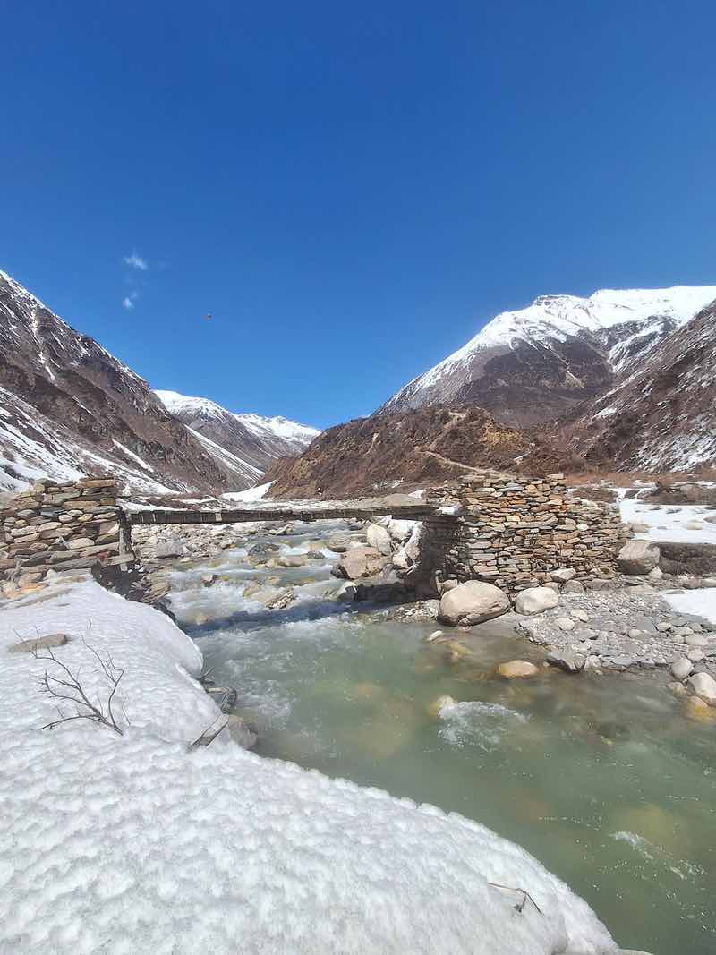
The trail begins with a descent to the Budhi Gandaki River, which you cross via a wooden bridge. From there, the path ascends gradually through barren landscapes with little vegetation. You may encounter yaks grazing along the way, adding to the remote and serene atmosphere.
As you trek higher, the air becomes thinner, and you may feel the effects of the altitude more acutely. It’s essential to maintain a steady pace and stay hydrated. The trail is well-marked and relatively easy to follow, with cairns and prayer flags guiding the way.
Upon reaching Dharamsala at 4,460 meters (14,632 feet), you’ll find a few basic teahouses that provide essential shelter and meals for trekkers. Dharmasala serves as the base camp for the ascent to Larkya La Pass, making it a crucial stop for acclimatization and rest. The accommodations here are more basic compared to lower altitudes, but they offer the necessary warmth and nourishment needed for the challenging days ahead.
Day 10: Acclimatization Day in Samdo
You spend an acclimatization day in Samdo, a village nestled at 3,860 meters. This day is crucial for adjusting to the altitude, ensuring you’re prepared for the higher elevations ahead. You begin with a relaxed morning, taking in the tranquil mountain surroundings.
To aid acclimatization, you venture on a hike to nearby viewpoints or explore the village itself, interacting with locals and learning about their way of life. The slower pace allows your body to adjust to the thinning air. You return to your teahouse for meals and rest, feeling rejuvenated and ready to continue your trek the following day.
Day 11: Dharamshala to Bhimtang
- Starting Point: Dharamshala (Larkya Phedi)
- Ending Point: Bhimthang
- Approximate Distance: 16-18 km (10-11 miles)
- Elevation Gain: Dharamshala (4,460 meters / 14,633 feet) to Larkya La Pass (5,160 meters / 16,929 feet), then descent to Bhimthang (3,590 meters / 11,778 feet)
- Trekking Duration: 8-10 hours
The trek from Dharamshala (Larkya Phedi) to Bhimthang is a challenging and rewarding part of the Manaslu Circuit Trek, known for crossing the high and demanding Larkya La Pass. Starting early in the morning from Dharamshala at 4,460 meters, trekkers embark on a steep ascent to the pass at 5,160 meters.
Though strenuous due to the altitude, the climb is compensated by breathtaking panoramic views of peaks like Himlung Himal, Cheo Himal, and Kang Guru from the top.
After the exhilarating experience at the pass, a long descent begins, navigating through moraines, glacial lakes, and rocky trails. Eventually, it leads to the lush, scenic valley of Bhimthang at 3,590 meters.
This 8-10 hour trek requires good acclimatization, preparation for sudden weather changes, and adequate hydration and nutrition. Upon reaching Bhimthang, trekkers can rest and enjoy the beautiful surroundings and the sense of accomplishment from conquering one of the highest passes in the region.
Day 12: Bhimtang to Dharapani
- Starting Point: Bhimtang
- Ending Point: Dharapani
- Approximate Distance: 22 km (14 miles)
- Elevation Loss: Bhimtang (3,590 meters / 11,778 feet) to Dharapani (1,860 meters / 6,102 feet)
- Trekking Duration: 7-8 hours
Starting from Bhimthang at 11,778 feet, you’ll begin a gradual descent through lush forests. The trail takes you through serene woodlands, across sparkling rivers, and past picturesque villages, allowing you to immerse yourself in the region’s natural beauty.
As you trek, you’ll pass through the charming village of Tilije, where the transition from alpine to more temperate climates becomes evident, with terraced fields and traditional houses dotting the landscape. This journey typically takes about 7-8 hours and covers a distance of approximately 22 kilometers (14 miles). You’ll find the walk more comfortable compared to the previous day’s challenging ascent and descent.
Upon reaching Dharapani at 6,102 feet, you can rest and reflect on the incredible journey you’ve had. This part of the trek brings you closer to your final destination and offers a peaceful and enriching experience as you traverse the heart of Nepal’s stunning landscapes.
Day 13: Dharapani to Kathmandu
Dharapani to Kathmandu
- Starting Point: Dharapani
- Ending Point: Kathmandu
- Approximate Distance: 230 km (143 miles) by road
- Elevation Change: Dharapani (1,860 meters / 6,102 feet) to Kathmandu (1,400 meters / 4,593 feet)
- Travel Duration: 8-10 hours by jeep or bus
On the journey from Dharapani to Kathmandu, you’ll transition from the serene, natural beauty of the mountains to the vibrant, bustling atmosphere of Nepal’s capital.
Starting from Dharapani at an elevation of 1,860 meters (6,102 feet), you’ll travel by road, descending to Kathmandu, which sits at 1,400 meters (4,593 feet). As you drive, you’ll encounter the picturesque Marsyangdi River, which will accompany you for a significant part of the journey, offering stunning river views and the sound of flowing water.
The road winds through lush green hills, terraced fields, and small villages where you can observe local life and culture. You might see traditional houses, local farmers working in the fields, and children waving as you pass by. The route also offers glimpses of majestic Himalayan peaks in the distance, reminding you of the high-altitude adventures you’ve just experienced.
As you approach Kathmandu, the landscape gradually changes. The rural scenery gives way to more urban settings, with increasing traffic and activity. Upon reaching Kathmandu, you’ll be greeted by the city’s lively streets, colorful markets, and a mix of ancient temples and modern buildings. This part of your journey provides a unique contrast, highlighting the diverse beauty and culture of Nepal.
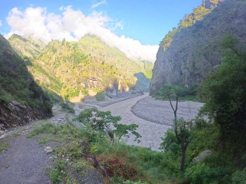
Crossing a River on the Manaslu Circuit
Health Risks on the Manaslu Circuit Trek
Acute Mountain Sickness (AMS) on the Manaslu Circuit Trek
The Manaslu Circuit Trek takes you through varied altitudes, eventually reaching heights above 5,000 meters (16,400 feet). Given these elevations, Acute Mountain Sickness (AMS) is a significant concern. Here’s a detailed explanation of AMS as it pertains to the Manaslu Circuit Trek:
Causes of AMS
AMS occurs when you ascend to high altitudes too quickly, and your body doesn’t have enough time to acclimatize to the reduced levels of oxygen. This can happen at altitudes above 2,500 meters (8,200 feet), but the risk increases significantly at higher elevations.
Symptoms of AMS
Mild to Moderate Symptoms:
- Headache: Often the first sign of AMS. It can range from mild to severe and is typically worse at night and in the morning.
- Nausea and Vomiting: Feeling sick to your stomach and vomiting.
- Dizziness and Lightheadedness: A common symptom due to reduced oxygen levels.
- Fatigue and Weakness: Feeling unusually tired and weak.
- Loss of Appetite: A decreased desire to eat.
- Difficulty Sleeping: Insomnia or poor sleep quality.
- Shortness of Breath: Particularly noticeable during exertion.
High Altitude Pulmonary Edema (HAPE) on the Manaslu Circuit Trek
High Altitude Pulmonary Edema (HAPE) is a severe and potentially life-threatening condition that can occur during high-altitude trekking, such as on the Manaslu Circuit Trek. Understanding HAPE is crucial for safety and proper response during your trek.
Causes of HAPE
HAPE occurs when fluid builds up in the lungs due to increased pressure in the pulmonary arteries at high altitudes. This condition usually develops within 2 to 4 days of ascending to altitudes above 2,500 meters (8,200 feet), although it can occur at lower altitudes in susceptible individuals.
Symptoms of HAPE
Early Symptoms:
- Shortness of Breath: This is initially noticeable during physical exertion, but it can progress to shortness of breath even at rest.
- Persistent Dry Cough: May progress to producing frothy or pink sputum.
- Chest Tightness: Sensation of tightness or pressure in the chest.
Advanced Symptoms:
- Extreme Fatigue and Weakness: Feeling exhausted and unable to carry on with normal activities.
- Rapid Breathing and Heart Rate: Increased respiratory and heart rates, even when resting.
- Cyanosis: Bluish tint to the lips and fingernails, indicating severe lack of oxygen.
- Crackling Sounds in the Lungs: Audible through a stethoscope or sometimes by ear.
High Altitude Cerebral Edema (HACE) on the Manaslu Circuit Trek
High Altitude Cerebral Edema (HACE) is a severe and life-threatening condition that can occur at high altitudes, such as on the Manaslu Circuit Trek. Recognizing the symptoms and understanding how to respond to ensure your safety is crucial.
Causes of HACE
HACE occurs due to brain swelling caused by a hypoxic (low oxygen) environment at high altitudes. This condition usually develops as a progression from Acute Mountain Sickness (AMS) if left untreated and can occur rapidly.
Symptoms of HACE
Early Symptoms:
- Severe Headache: Persistent and severe, not relieved by common painkillers.
- Nausea and Vomiting: Often accompanies headaches.
Advanced Symptoms:
- Confusion and Disorientation: Difficulty thinking clearly or understanding surroundings.
- Loss of Coordination (Ataxia): Unsteady walking, clumsiness, and difficulty performing simple tasks.
- Hallucinations: Seeing or hearing things that aren’t there.
- Severe Lethargy: Extreme tiredness and weakness.
- Behavioral Changes: Irritability, irrational behavior, or emotional instability.
- Coma: In extreme cases, the individual may lose consciousness.
Specific Points of Concern on the Manaslu Circuit Trek
- Samagaon (3,530 meters):
- Initial signs of HACE may appear here. Be vigilant if AMS symptoms have been persistent.
- Samdo (3,860 meters):
- Higher altitude increases the risk. Pay attention to any worsening symptoms.
- Dharamsala (4,460 meters):
- High risk due to significant altitude. Ensure proper acclimatization before proceeding further.
- Crossing Larke La Pass (5,106 meters):
- This is the highest and most challenging part of the trek. If symptoms of HACE develop, immediate action is required.
Prevention of HACE
Gradual Ascent:
- To acclimate your body, follow a gradual ascent profile. Rest days in Namrung, Samagaon, and Samdo are essential.
Monitor Symptoms:
- Regularly check for signs of AMS, which can precede HACE. Take immediate action if symptoms worsen.
Stay Hydrated:
- Drink plenty of fluids to stay hydrated but avoid overhydration.
Proper Diet:
- Eat a high-calorie diet rich in carbohydrates to maintain energy levels.
Medication:
- Consider taking Diamox (acetazolamide) for AMS prevention. Consult your doctor before trekking.
 Everest Base Camp Trek: A Journey to the Roof of the World in Nepal
 Trekking the Annapurna Circuit in Nepal – Episode 492
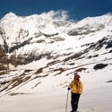 Roopkund Trek: My Himalayan Death Trek – India
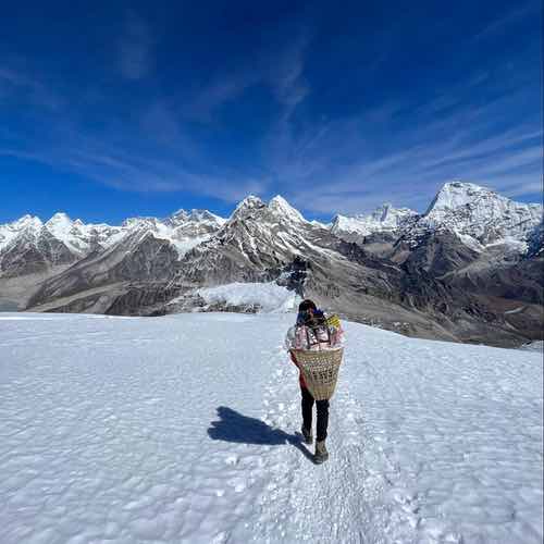 Best Trekking Places in Nepal: My Personal Experience with Additional Trekking Tips