Things to do in the Virgin Islands
categories: caribbean travel
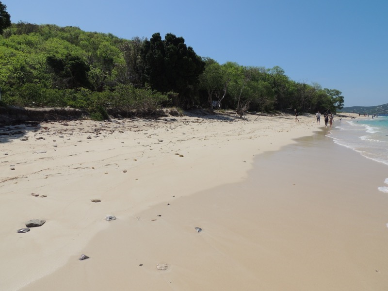
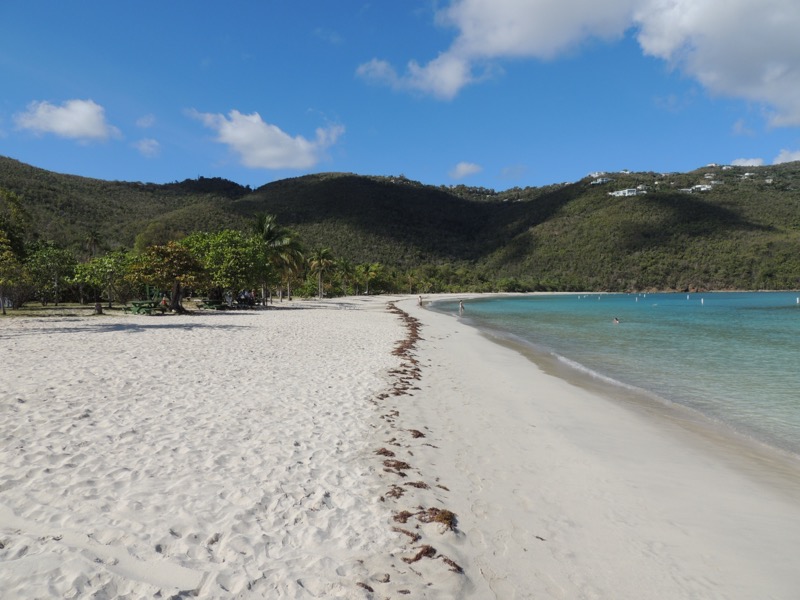
Trunk Bay, Saint John
I have been attempting to visit most of the Caribbean islands for several years. This portion of my travel covered the United States and the British Virgin Islands, with special emphasis on their national parks.
The Virgin Islands were named by Christopher Columbus in 1493, on his second voyage, for St. Ursula and her 11,000 virgins. I’ve been to Saint Thomas twice over thirty years, but Saint Croix and Saint John eluded me.
Table of contents: ()
Things to do in Saint Croix, US Virgin Islands
My first island was Saint Croix, USVI, after a flight from Miami.
I picked up a Toyota C-HR from Budget rental car on arrival. All the islands drive on the left-hand side. Saint Croix is the only island in the US surrounded by the Caribbean Sea and is 28 miles long by 7 miles wide. It is not volcanic in origin but formed by uplifting.
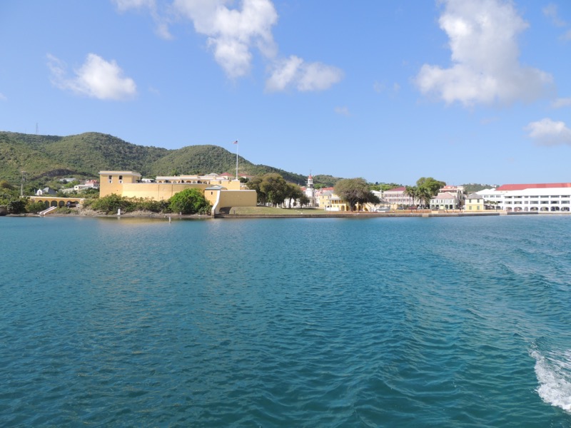
Christiansted
I checked into Holger Danske Hotel on the harbor boardwalk in downtown Christiansted. A gecko was my room’s watchdog. A warm evening stroll took me to Brew STX for dinner.
Saint Croix is the land of “Sun, Sand, & Sea”. It was named by Christopher Columbus “Holy Cross”. The Danes settled the island in 1735. The US bought it from the Dutch in 1917 to protect the Panama Canal for $25 million in gold.
The capital, Christiansted, was part of the “Triangular Trade” (trinkets & rum from Europe to Africa for Slaves to the Caribbean for sugar & molasses back to New England or Europe). At its peak, the island had 264 sugar mills which ended after a slave revolt in 1878.
- Get an eSim to be able to use your smartphone abroad.
- Get a Car Rental
- Get a universal plug adapter
- Book Your Accommodation HERE
- Buy Travel Insurance
- Search for Great Tours HERE
Buck Island Reef National Monument
As a retired National Park ranger, I was working on my National Park Service (NPS) unit life list. I would venture to five on this trip. The first was Buck Island Reef National Monument. Established in 1961 to protect Buck Island (volcanic) and one of the finest Caribbean marine gardens with Elkhorn coral and Brain coral. Unfortunately, climate change and hurricanes have done a number on the population.
The park has an underwater nature trail which I snorkeled. Easily 50-foot visibility. The different shades of the water’s color are amazing. I traveled to Buck Island on a tour. Big Beard Adventures’ Captain Curtis took me out for a half day aboard the M/V Adventure. The island is six miles offshore.
We spent an hour on West (AKA Turtle) Beach where I viewed the endangered Brown Pelican and Saint Croix Gecko, Pope’s Head cactus, and Organ Pipe (or dildo) Cactus. The fish I saw snorkeling included the angelfish, blue tangs, School Master, Trumpet Fish, Stoplight Parrot Fish, Trail Parrot Fish, jellyfish, and Sergeant Major.
Don’t forget to put on your “reef safe” suntan lotion. I forgot the tops of my feet! I’d wait to purchase the reef-safe suntan lotion once you arrived. Nothing I saw in the States specifically said reef safe like they do here.
The return trip was highlighted by bottomless Mutiny Island Vodka (made from breadfruit) punch. I found island food is very spicy. I had a fish gumbo at Cruzian Bayou Bistro which burned my lips, but I did get to try a shot of Mama Juana (strong homemade herbal rum).
Christiansted National Historic Site
My next park was Christiansted National Historic Site which is a small run-down grouping of four colonial Danish buildings and Fort Christiansvaern. Sadly, I saw no open visitor center and no visible staff on duty.
I continued my walk-through Christiansted past the Governor’s office and visited four building sites connected with Alexander Hamilton’s life on the island. His plantation house, Hamilton Grange, is private property. I took an afternoon drive to see Maureen O’Hara’s Sky Hawk Villa. Unfortunately, the damage from Hurricane Hugo has left it in ruins.
Saint Croix National Heritage
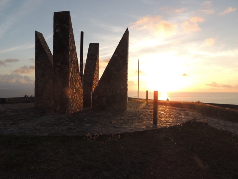
I woke up early the next day to catch the first rays of the sun (6 AM) on the United States at Point Udall. It is the easternmost point (by travel, not longitude) of the United States and was named for Secretary of the Interior Stewart Udall. A sundial known as the Millennium Monument was built above the Point for New Year’s 2000. It marks the azimuth of the first U.S. sunrise of that year. This Point is part of the newly established Saint Croix National Heritage Area and the island’s East End Marine Park.
Nearby is a Very Long Baseline Array (VLBA) telescope that is part of a network of 10 on the planet that measures celestial bodies.
Frederiksted
I drove from the far east end to the far west end and the city of Frederiksted. I was shocked at how run down this city was compared to Christiansted. Saint Croix is nicknamed the “Twin Cities” because they have two cities on the island. I wanted to see the 1752 Fort Frederik. It was similar in design to Fort Christiansvaern. The fort fired the first salute to the American Stars and Stripes flag from foreign soil here in June 1776. It was here that the Danish Governor emancipated the island’s slaves in 1848. The fort’s museum had an exhibit of Chaney which are pieces of Dutch sugar plantation china found washed up on beaches or at abandoned estates and is unique to the island.
-Salt River Bay NHP & Ecological Preserve-Saint Croix-USVI.JPG)
Salt River Bay National Historical Park and Ecological Reserve
My third NPS unit to visit was Salt River Bay National Historical Park and Ecological Reserve established in 1962. Salt River is where Columbus landed on that 2nd voyage in 1493. His landing didn’t go well. He had the first documented armed conflict between Europeans & Carib Indians at Cape of the Arrows.
The site ultimately became the first European settlement on the island before the settlement moved to Christiansted.
The ecological part protects the largest remaining mangrove forest in the USVI and a submarine canyon. The visit was very disappointing. There was no NPS presence. The visitor center is being rebuilt after having been destroyed by Hurricane Irma. The park campground was placed on top of the island’s primary Carib village site which had a reported ball court. The area is trashed and now is a homeless encampment with weathered USVI notices to vacate.
Leaving the park, the sky opened for my only rain as I stopped for lunch at La Reine Chicken Shack. The grilled chicken was dry, but the Johnnycake (thin cornmeal roll with air pocket) was good. For dinner, I ate at El Sol and had “pot fish” (fish of the day in the pot) and Mofongo (fried mashed plantain ball). Today’s fish was Snapper.
I drove 132 miles around the island in two days. Crucians are very friendly. Strolling through the towns everyone greets you. I tasted Cruzan Rum and tried Tamarind Ball candy (sweet and sour taste). I saw a couple of mongooses darting across the road. In the morning, the air has a sweet floral scent.
Saint Thomas
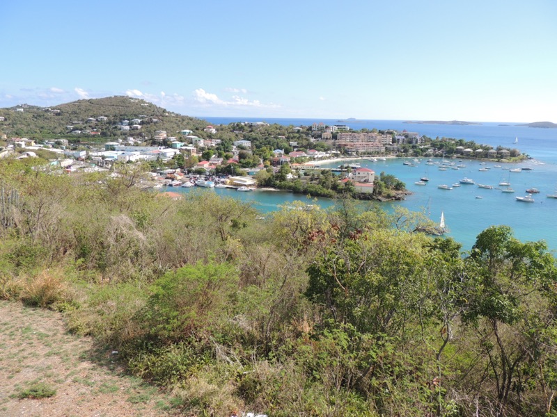
Leaving Saint Croix, I flew aboard Cape Air’s Cessna to Saint Thomas, USVI. I was surprised to see no TSA security for the flight between islands. I had been to Saint Thomas twice before. I was met at the airport by Nami (Jordanian) of Paradise Taxi who gave me a short tour of the island before arriving at the Red Hook ferry terminal for my ferry to Saint John.
Saint Thomas was in the midst of their Carnival celebration. It’s pretty much a cruise ship port with lots of duty-free shopping. There’s pirate Blackbeard’s (Edward Teach) Castle, a Danish watchtower built in 1679. From here I had on a previous visit walked down the “99 Steps” to visit Fort Christian, formerly Saint Thomas National Historic Site, from 1960-1975, and the oldest building in continuous use on Saint Thomas.
The best views of the islands are from Paradise Point and Mountaintop. A visit to the 16th-century privateer Sir. Francis Drake’s Seat (overlook) gives a commanding view of the British Virgin Islands and Magen’s Bay Beach (reported to be Drake’s hangout) until it was time for the ferry.
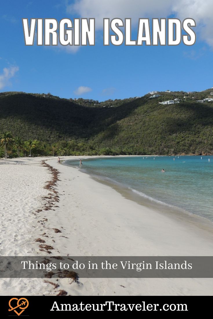
Magens Bay Beach – Saint Thomas
Magen’s Bay Beach was voted one of the world’s most beautiful beaches by National Geographic and the land was donated by the Fairchild family. It’s a mile-long palm-lined white sand horseshoe-shaped beach with Brown Pelicans and a Brown Booby.
Things to do in Saint John, US Virgin Islands
I took the twenty-minute Saint John Ferry Service M/V Red Hook 1 across the 4-mile channel to Cruz Bay, Saint John, USVI.
Saint John is nine miles long and five miles wide. In 1493, Christopher Columbus sailed past it on his second voyage. It was eventually settled by the Danish West India Company in 1717.
I picked up a Ford Bronco from L&L Rental and checked into Saint John’s Inn. A lovely B&B style accommodation with two cats and complimentary Paradise Gold Rum punch happy hour every night. The manager Jim was a wonderful host. For lunch, I had a good wrap at Roti King food truck.
Virgin Island National Park
Virgin Island National Park is my fourth NPS unit. The park was established in 1956 with the initial land donation by the Rockefeller family. It is primarily second growth as most of the land was cleared for sugar cane production.
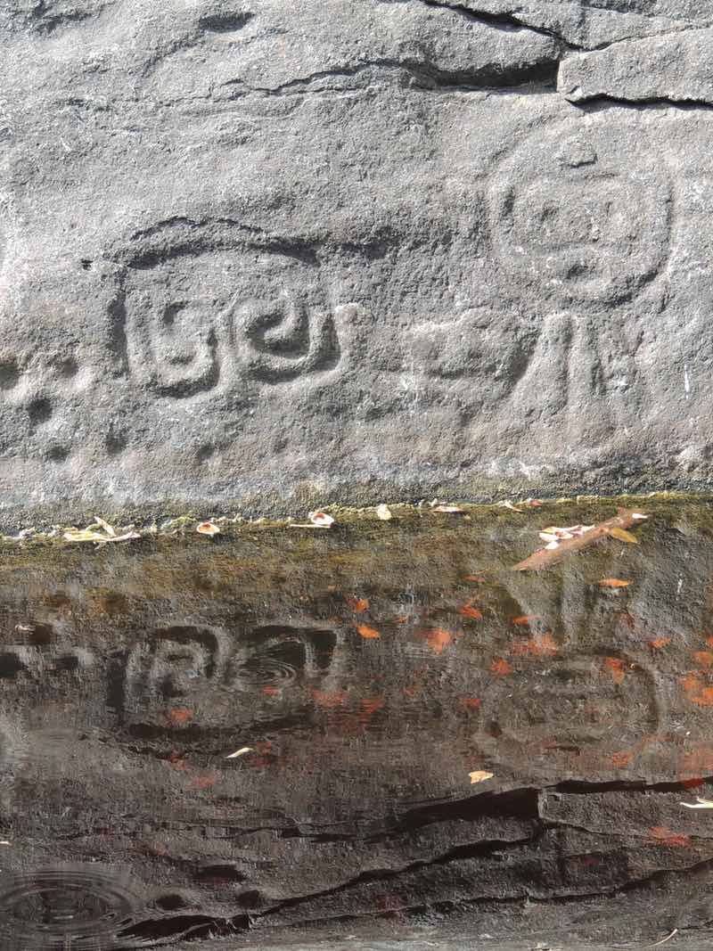
In the afternoon, I hiked the Reef Bay Trail to the petroglyphs. They are estimated to be 1000 years old. There are several human faces. The 2.2-mile round trip had a strenuous uphill climb out and follows an old Dutch estate road. You pass the ruins of several sugar cane estates. I viewed several plants like the Pinuela, Locust Tree, Kapok Tree, West Indian Locust, Mango, and the thorny Sandbox Tree. Wildlife included Mongoose, White-Tailed Deer, Crested Anole, Brown Anole, Jack Spaniard, and a Gungalo.
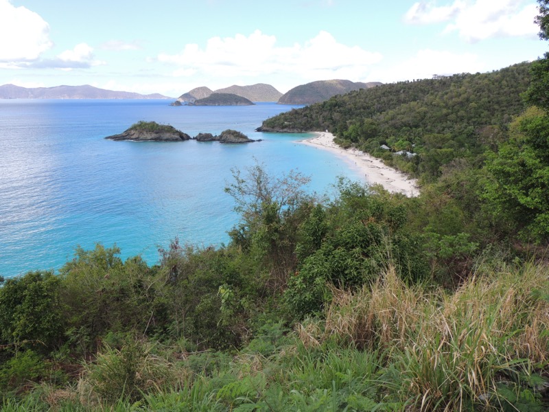
I was never so disappointed in an NPS site, as Virgin Islands. The beaches and scenery are beautiful, but it needs some attention in visitor services. Trunk Bay underwater nature trail was a big disappointment compared to Buck Island and later Hurricane Hole. There wasn’t much to see except a Southern Stingray.
My visit included the 1797 Danish Annaberg Sugar Mill ruins. My last stop was a view of Rockefeller’s Caneel Bay Resort. Hurricane Irma and Maria in 2017 left the resort in ruins and it has not been rebuilt despite receiving FEMA and insurance money. Dinner was at Banana Deck Restaurant where I enjoyed conch fritters.
Virgin Islands Coral Reef National Monument
Starting the day with a nice breakfast at Cruz Bay Landing, my final NPS unit was the Virgin Islands Coral Reef National Monument established in 2001. It is the only NPS unit without any dry land. It’s all offshore coral reefs and mangroves. I spent the morning kayaking and snorkeling in Hurricane Hole with my guide Scott from Virgin Island Expedition Company. Scott was knowledgeable and patient.
We put in at Princess Bay. We must have kayak paddled two miles before snorkeling for an hour in Water Creek. I saw various corals, Southern Stingray, Queen Conch, snapper, angelfish, and barracuda. I don’t recall cutting my foot on coral, but it was bleeding.
Next, I drove to Fortsberg. The ruins of a 1717 Danish Fort. The shore battery still had five cannons undisturbed.
I followed this with lunch at Miss Lucy’s Restaurant on Friis Bay. It was excellent. I had a Grouper Ruben and Kallaloo (okra and crab soup). Dinner was at High Tide Bar with a nice seafood fettuccine and a beautiful sunset.
I found Saint John not to be the paradise island people claim. Of the three USVI, this island had a lot of illegal roadside dumping. The island’s nickname is “Love City” because the place is safe, and the people are friendly. Cruz Bay has no free parking in town. Gas is $5 a gallon. I drove 41 miles around the island in two days. There are not many many chickens as on Saint Croix but there were lots of goats and donkeys running unconfined. The three main roads (North, Centerline, and South) are narrow and mountainous. The Virgin Islands use the term “estate” to identify geographical areas which relate back to the original plantation estate boundaries.
Using a credit card throughout the three islands will incur a 3% service charge on your bill. Both Cruz Bay and Charlotte Amalie have free public Wi-Fi.
I ferried back the 45 minutes and twelve miles to Charlotte Amalie, Saint Thomas, on the Saint John Ferry Service’s M/V Lady Venture. I had conch and fungi (cornmeal and okra) for lunch at the Petite Pump Room in the Marine Terminal.
Things to do in Virgin Gorda, British Virgin Islands
After lunch, I boarded the Road Town Fast Ferry M/V Lady Caroline for the 22-mile and one-hour ride to Road Town, Tortola, British Virgin Islands (BVI). I cleared HM Customs and paid the environmental tax (which supports the island’s environmental protection programs).
The BVI is composed of approximately 50 islands. Then it was my final twelve miles and 25-minute Native Son Ferry M/V Ella-G ride to Spanish Town, Virgin Gorda (fat virgin), BVI. Virgin Gorda is eight square miles. Spanish Town is the center of the volcanic crater that created the island.
I checked into the Bayview Vacation Apartments. A lovely three-story apartment basically across the street from the ferry terminal. But, oh the stairs on my already tired leg muscles. I walked into town for dinner at the Village Cafe and had Conch Roti with a Painkiller (rum cocktail). I can’t say enough about the staff. I left my credit card, and they tracked me down to return it that night! I’ll blame it on the Painkiller!
After breakfast at Bath & Turtle, I picked up a Suzuki Jimny from Speedy’s Rental Car.
Spring Bay National Park
Spring Bay National Park was my first stop. It is a small bay enclosed by a circle of boulders forming a natural corral. I saw Caribbean Land Hermit Crabs, Crested Anole, and a cactus called Mottled Spurge.
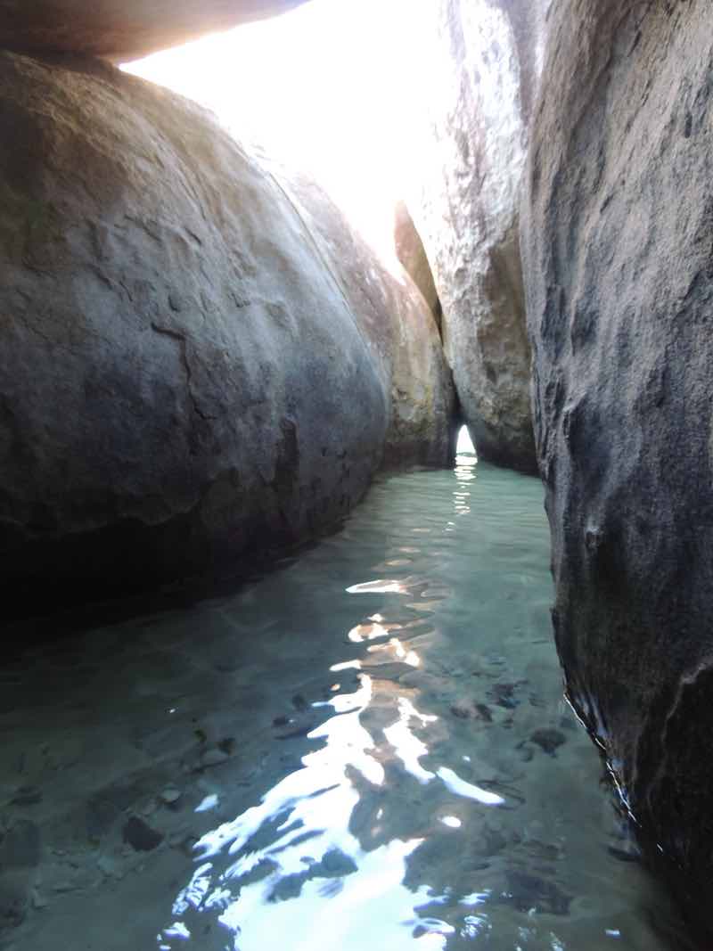
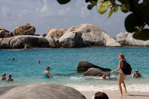
The Baths National Park
Next, I visited the world-famous The Baths National Park. The Baths has huge, sculptured boulders along the shore creating a labyrinth of clear blue pools and shallow coves which I waded through and then swam on the adjoining beach.
Devil’s Bay National Park’
Then, I hiked along Devil’s Bay National Park’s horseshoe-shaped snorkeling beach and to several side beaches for views.
Coppermine Point National Park
Next, it was over to Coppermine Point National Park which preserves the ruins of an abandoned copper mine with a short trail.
Gorda Peak National Park
My last park was to view Gorda Peak National Park donated by the Rockefeller family. It is the highest point on the island. BVI has about 28 national parks that are managed by the NGO BVI National Parks Trust (NPT).
For my last dinner in BVI, I treated myself to BVI Lobster at the Sugarcane Restaurant. It was good. Unfortunately, I was joined by about 30 flies. They say the seafood attracted them because everybody else was having something else. I drove 41 miles around the island in one day. The island has an overpopulation of speed bumps.
After a ham & egg Johnnycake breakfast at Bath & Turtle, I took Speedy’s Ferry Service M/V Unforgettable the seven miles and twenty-minute ride to Beef Island to catch my Win Air flight.
 Travel to the Virgin Islands – Episode 181
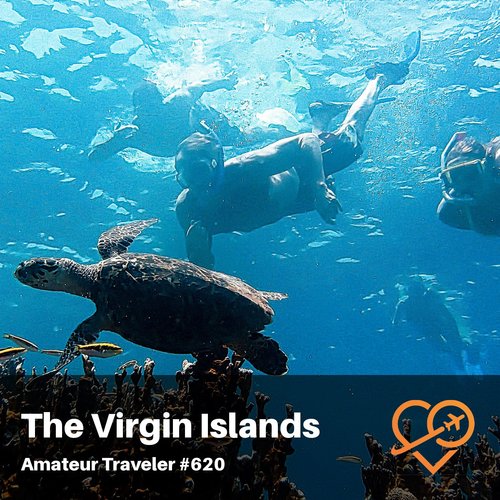 Sail the Virgin Islands – Episode 620
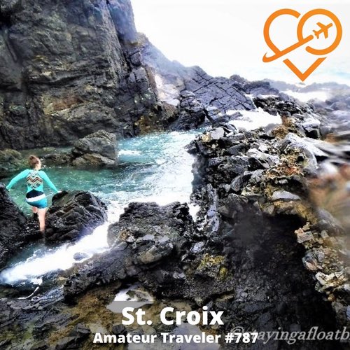 Travel to Saint Croix – Episode 787
 Travel to the Leeward Islands of the Lesser Antilles in the Caribbean – Episode 386
by Jeff Ohlfs
Jeff Ohlfs is a retired National Park Ranger with more than 40 years in protected area management. An avid traveler since childhood, he has traveled over 1.8 million miles by land, sea, and air to seven continents and almost a hundred countries.Leave a Reply
Tags: article, british virgin islands, united states virgin islands